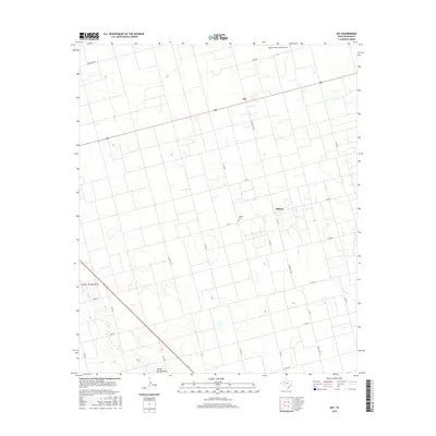
2016 Map of Key
USGS Topo · Published 2016About this map
Midway and the community of Key anchor this high plains landscape in Dawson County, defined by a rigid grid of agricultural roads and the intermittent drainage of Sulphur Springs Draw. The map captures a quintessential West Texas rural infrastructure where local life centers around the Midway Cem and the small-scale aviation of the Benny White Flying Airport. Transport in this era is dominated by the intersection of Highway 180 and Highway 87, which cut through the landscape alongside a network of ranch roads like Ranch Rd 178. The terrain is generally flat, marked by subtle depressions and the headwaters of Gold Cr, reflecting the region's reliance on managed land use and wide-open ranching tracts. This survey provides a precise look at property boundaries and rural settlements before further consolidation or modern development altered the footprint of these small farming hubs.
Find a feature on this map
27 named features on this map. Tap any name to fly to it.
Don’t see what you’re looking for? This feature index may not catch every label — zoom into the map to look around manually.
Map Details
Editions of this 2016 Key Map
This is the sole edition of this map. No revisions or reprints were ever made.
Other maps of this area

1954 · Big Spring
USGS Topo · 1:250,000

1958 · Big Spring
USGS Topo · 1:250,000

1968 · Lamesa North
USGS Topo · 1:24,000

1968 · Hancock
USGS Topo · 1:24,000

1969 · Indian Canyon
USGS Topo · 1:24,000

1970 · Lamesa South
USGS Topo · 1:24,000

1970 · Ackerly
USGS Topo · 1:24,000

1970 · Key
USGS Topo · 1:24,000
1970 · Tenmile
USGS Topo · 1:24,000

1970 · Sand Creek
USGS Topo · 1:24,000