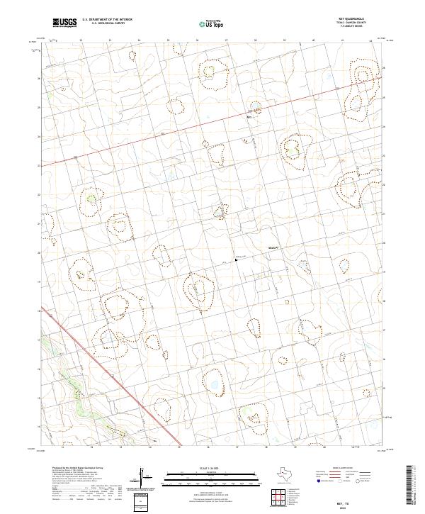
2022 Map of Key
USGS Topo · Published 2022About this map
Midway and the nearby Key settlement anchor this portion of Dawson County, characterized by a structured grid of rural roads and seasonal watercourses. The landscape is defined by the broad path of Sulphur Springs Draw in the southwest and Gold Cr to the east, illustrating the drainage patterns of the Texas South Plains. This map provides specific data for genealogists and local historians, pinpointing the location of the Midway Cem situated along CR 24. A network of thoroughfares, including Ranch Rd 827 and Fm 26 N, connects these agrarian communities, reflecting a modern era of land management while preserving the footprint of earlier rural developments.
Find a feature on this map
24 named features on this map. Tap any name to fly to it.
Don’t see what you’re looking for? This feature index may not catch every label — zoom into the map to look around manually.
Map Details
Editions of this 2022 Key Map
This is the sole edition of this map. No revisions or reprints were ever made.
Other maps of this area

1954 · Big Spring
USGS Topo · 1:250,000

1958 · Big Spring
USGS Topo · 1:250,000

1968 · Lamesa North
USGS Topo · 1:24,000

1968 · Hancock
USGS Topo · 1:24,000

1969 · Indian Canyon
USGS Topo · 1:24,000

1970 · Lamesa South
USGS Topo · 1:24,000

1970 · Ackerly
USGS Topo · 1:24,000

1970 · Key
USGS Topo · 1:24,000
1970 · Tenmile
USGS Topo · 1:24,000

1970 · Sand Creek
USGS Topo · 1:24,000