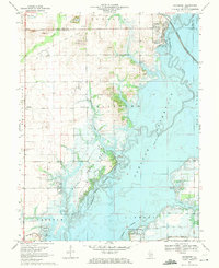
1969 Map of Keyesport
USGS Topo · Published 1971About this map
Carlyle Reservoir dominates this landscape, its waters having transformed the valley of the Kaskaskia River and several tributaries including Allen Branch and Coles Creek. The 1969 field check captures the area during its transition into a major regional recreation hub, showing the early layouts of Hazlet State Park and South Shore State Park alongside established landmarks like Keyesport and Marydale. Local history is preserved through the inclusion of family and community landmarks such as McKendree Cem, Gillespie Cem, and Hopewell Ch. Industrial footprints are also visible, ranging from the Keyesport Oil Field to the Burlington Northern railroad line running north-south through the village, and several gravel pits that served the local area before the reservoir's full expansion.
Find a feature on this map
35 named features on this map. Tap any name to fly to it.
Don’t see what you’re looking for? This feature index may not catch every label — zoom into the map to look around manually.
Map Details
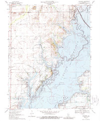
Editions of this 1969 Keyesport Map
2 editions found
Other maps of this area

1910 · Carlyle
USGS Topo · 1:62,500

1914 · Centralia
USGS Topo · 1:62,500

1932 · Greenville
USGS Topo · 1:62,500

1935 · Centralia
USGS Topo · 1:62,500

1939 · Greenville
USGS Topo · 1:62,500

1943 · Greenville
USGS Topo · 1:62,500

1945 · Vandalia
USGS Topo · 1:62,500

1947 · Vandalia
USGS Topo · 1:62,500

1948 · Carlyle
USGS Topo · 1:62,500

1958 · Belleville
USGS Topo · 1:250,000