
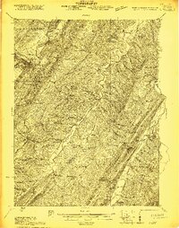
1921 Map of Keyser
USGS Topo · Published 1921About this map
The Potomac River and South Branch Potomac River define the winding valleys of this 1921 survey, where the Baltimore and Ohio RR follows the rugged terrain through Keyser and McCool. This era shows a landscape dense with rural infrastructure, including a remarkable concentration of local education sites such as Knobly School, Mill Dale School, and the Red Star School. The region’s economic and social hubs are clearly marked, from the industrial Ochre works and Reeses Mill to the Hampshire Club on the South Branch.
Find a feature on this map
124 named features on this map. Tap any name to fly to it.
Don’t see what you’re looking for? This feature index may not catch every label — zoom into the map to look around manually.
Map Details
Editions of this 1921 Keyser Map
2 editions found
Other maps of this area

1891 · Romney
USGS Topo · 1:125,000

1895 · Piedmont
USGS Topo · 1:125,000

1898 · Frostburg
USGS Topo · 1:62,500

1899 · Flintstone
USGS Topo · 1:62,500

1899 · Grantsville
USGS Topo · 1:62,500

1900 · Flintstone
USGS Topo · 1:62,500

1901 · Frostburg
USGS Topo · 1:62,500

1904 · Grantsville
USGS Topo · 1:62,500

1908 · Frostburg
USGS Topo · 1:62,500

1919 · Elk Garden
USGS Topo · 1:48,000