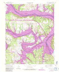
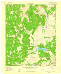
1958 Map of Keystone Dam
USGS Topo · Published 1983About this map
Keystone Lake dominates this landscape where the Arkansas River and Cimarron River converge. The terrain is marked by extensive recreation zones such as Washington Irving Cove Recreation Area and Appalachia Bay Recreation Area, reflecting the area's development into a major regional reservoir system. Significant changes are visible near Prue, with its newer counterpart New Prue established nearby, and the town of Mannford located along the Burlington Northern line. The map captures a complex intersection of county lines, including Osage, Tulsa, and Creek counties. Local history is anchored by rural institutions like Rigsby Sch and family burial sites including Doyle Cem and Sinnett Cem, while the presence of numerous Oil Wells across the hills points to the persistent energy industry of the region.
Find a feature on this map
41 named features on this map. Tap any name to fly to it.
Don’t see what you’re looking for? This feature index may not catch every label — zoom into the map to look around manually.
Map Details
Editions of this 1958 Keystone Dam Map
4 editions found
Other maps of this area

1912 · Hominy
USGS Topo · 1:125,000

1915 · Hominy
USGS Topo · 1:125,000

1915 · Hominy
USGS Topo · 1:62,500

1955 · Enid
USGS Topo · 1:250,000

1958 · Enid
USGS Topo · 1:250,000

1958 · Keystone Dam
USGS Topo · 1:24,000
1958 · Mannford SE
USGS Topo · 1:24,000

1958 · Wekiwa
USGS Topo · 1:24,000
1959 · Lake Sahoma
USGS Topo · 1:24,000

1966 · Cleveland
USGS Topo · 1:24,000