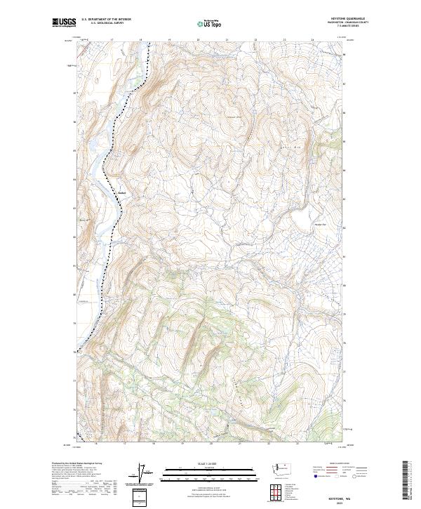
2023 Map of Keystone
USGS Topo · Published 2023About this map
The Okanogan River carves a deep valley through this northern Washington landscape, punctuated by the white water of McLoughlin Falls and McAllister Rapids. The settlement of Barker sits along the river's western bank, serving as a rare point of habitation in a region dominated by dramatic elevation changes. To the east, the terrain rises sharply toward Stowe Mtn and Baker Mtn, while the southern portion of the map is defined by the high elevations of Lockman Ridge and the descent into Killgore Canyon.
Find a feature on this map
42 named features on this map. Tap any name to fly to it.
Don’t see what you’re looking for? This feature index may not catch every label — zoom into the map to look around manually.
Map Details
Editions of this 2023 Keystone Map
This is the sole edition of this map. No revisions or reprints were ever made.
Other maps of this area

1902 · Osoyoos
USGS Topo · 1:125,000

1904 · Osoyoos
USGS Topo · 1:125,000

1905 · Okanogan
USGS Topo · 1:125,000

1906 · Chopaka
USGS Topo · 1:125,000

1953 · Omak Lake
USGS Topo · 1:62,500

1954 · Okanogan
USGS Topo · 1:250,000

1957 · Okanogan
USGS Topo · 1:62,500

1957 · Conconully
USGS Topo · 1:62,500

1957 · Tonasket
USGS Topo · 1:62,500

1958 · Okanogan
USGS Topo · 1:250,000