
2011 Map of Keysville
USGS Topo · Published 2011About this map
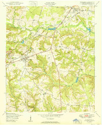
Keysville and its surrounding rural landscapes are defined by a complex network of tributaries feeding into Brier Creek, which meanders eastward through the center of the region. This 2011 survey reveals a settlement pattern deeply rooted in family and community history, evidenced by numerous small burial grounds such as the Pol Hill Cemetery, Clarks Chapel Cemetery, and George Palmer Cemetery. The landscape transitions from the concentrated town center of Keysville to smaller locales like Dyes Crossroad and Saint Clair.
Find a feature on this map
58 named features on this map. Tap any name to fly to it.
Don’t see what you’re looking for? This feature index may not catch every label — zoom into the map to look around manually.
Map Details
Editions of this 2011 Keysville Map
This is the sole edition of this map. No revisions or reprints were ever made.
Other maps of this area

1919 · Gough
USGS Topo · 1:62,500

1920 · Stapleton
USGS Topo · 1:62,500

1922 · Harlem
USGS Topo · 1:62,500

1922 · Hephzibah
USGS Topo · 1:62,500

1948 · Hephzibah
USGS Topo · 1:62,500

1948 · Harlem
USGS Topo · 1:62,500

1948 · Stapleton
USGS Topo · 1:62,500

1948 · Gough
USGS Topo · 1:62,500

1948 · Blythe
USGS Topo · 1:24,000
1950 · Hephzibah
USGS Topo · 1:24,000