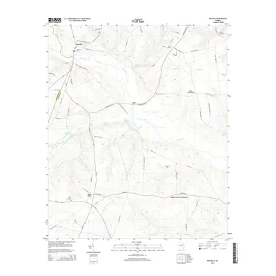
2014 Map of Keysville
USGS Topo · Published 2014About this map
Keysville serves as the primary hub in this corner of eastern Georgia, situated where the Jefferson and Burke county lines meet. The landscape is defined by the winding course of Brier Creek and its many tributaries, including Brushy Creek and Beaver Dam Cr. To the south and east, smaller residential clusters like Saint Clair and the Walker Grove Settlement are connected by a network of rural routes such as Quaker Rd and Taylor Rd. Genealogists will find a significant concentration of local burial sites scattered across the countryside, ranging from the Keysville Community Cem to family-named landmarks like Pol Hill Cem and the George Palmer Cem. The presence of Marks Mill Pond and Timmons Pond suggests a legacy of water-management and agricultural industry that has long shaped these creek bottoms.
Find a feature on this map
72 named features on this map. Tap any name to fly to it.
Don’t see what you’re looking for? This feature index may not catch every label — zoom into the map to look around manually.
Map Details
Editions of this 2014 Keysville Map
This is the sole edition of this map. No revisions or reprints were ever made.
Other maps of this area

1919 · Gough
USGS Topo · 1:62,500

1920 · Stapleton
USGS Topo · 1:62,500

1922 · Harlem
USGS Topo · 1:62,500

1922 · Hephzibah
USGS Topo · 1:62,500

1948 · Hephzibah
USGS Topo · 1:62,500

1948 · Harlem
USGS Topo · 1:62,500

1948 · Stapleton
USGS Topo · 1:62,500

1948 · Gough
USGS Topo · 1:62,500

1948 · Blythe
USGS Topo · 1:24,000
1950 · Hephzibah
USGS Topo · 1:24,000