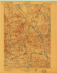
1911 Map of Kezar Falls
USGS Topo · Published 1920About this map
Hiram and the surrounding villages along the Saco River define this era of rural New England commerce, where water power and rail transit intersect. The Maine Central railroad tracks follow the river's path, connecting hubs like Brownfield Sta and Bridgton Junction. This network supported local industry and agriculture, evidenced by scattered family-named landmarks like Merrill Corner and Rankins Mill. Education and social life were deeply localized, with numerous small district buildings such as the Haley School, Tripptown School, and the more prominent Parsonsfield Seminary serving the hill communities.
Find a feature on this map
140 named features on this map. Tap any name to fly to it.
Don’t see what you’re looking for? This feature index may not catch every label — zoom into the map to look around manually.
Map Details
Editions of this 1911 Kezar Falls Map
5 editions found

Other maps of this area

1891 · Buxton
USGS Topo · 1:62,500

1891 · Newfield
USGS Topo · 1:62,500

1892 · Buxton
USGS Topo · 1:62,500

1893 · Buxton
USGS Topo · 1:62,500

1893 · Newfield
USGS Topo · 1:62,500

1894 · North Conway
USGS Topo · 1:62,500

1896 · Norway
USGS Topo · 1:62,500

1896 · Sebago
USGS Topo · 1:62,500

1896 · North Conway
USGS Topo · 1:62,500

1909 · Fryeburg
USGS Topo · 1:62,500