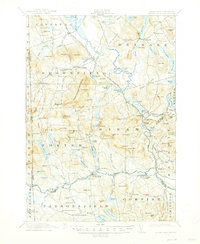
1911 Map of Kezar Falls
USGS Topo · Published 1947About this map
The Saco River defines the central axis of this landscape, carving a winding path through the borderlands of Oxford and York counties. At the turn of the century, the region's economy centered on the river and the Maine Central RR, with industry clustered at places like Kezar Falls and Cornish. The surveyor recorded a network of small upland settlements and neighborhood institutions, from the Parsonsfield Seminary in the south to the Haley School in the north.
Find a feature on this map
157 named features on this map. Tap any name to fly to it.
Don’t see what you’re looking for? This feature index may not catch every label — zoom into the map to look around manually.
Map Details
Editions of this 1911 Kezar Falls Map
5 editions found

Other maps of this area

1891 · Buxton
USGS Topo · 1:62,500

1891 · Newfield
USGS Topo · 1:62,500

1892 · Buxton
USGS Topo · 1:62,500

1893 · Buxton
USGS Topo · 1:62,500

1893 · Newfield
USGS Topo · 1:62,500

1894 · North Conway
USGS Topo · 1:62,500

1896 · Norway
USGS Topo · 1:62,500

1896 · Sebago
USGS Topo · 1:62,500

1896 · North Conway
USGS Topo · 1:62,500

1909 · Fryeburg
USGS Topo · 1:62,500