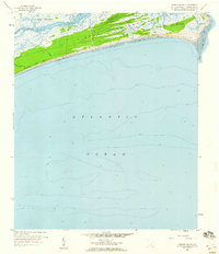
1959 Map of Kiawah Island
USGS Topo · Published 1960About this map
Kiawah Island is depicted here during a period of minimal development, long before it became the resort community known today. The landscape is defined by the winding course of the Kiawah River and its numerous tidal tributaries, including Haulover Cr and Cinder Creek. A single primary artery, Kiawah Island Drive, runs along the southern coast, providing access to the shoreline overlooking the Atlantic Ocean.
Find a feature on this map
17 named features on this map. Tap any name to fly to it.
Don’t see what you’re looking for? This feature index may not catch every label — zoom into the map to look around manually.
Map Details
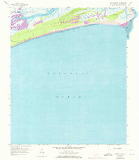
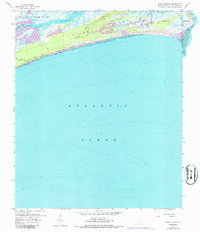
Editions of this 1959 Kiawah Island Map
3 editions found
Other maps of this area

1918 · Kiawah Island
USGS Topo · 1:21,120

1919 · Wadmelaw Island
USGS Topo · 1:62,500

1919 · James Island
USGS Topo · 1:21,120

1919 · Legareville
USGS Topo · 1:21,120

1943 · Legareville
USGS Topo · 1:24,000

1943 · James Island
USGS Topo · 1:24,000

1943 · Kiawah Island
USGS Topo · 1:24,000

1944 · Wadmelaw Island
USGS Topo · 1:62,500

1947 · Savannah
USGS Topo · 1:250,000

1948 · James Island
USGS Topo · 1:250,000