
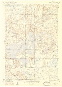
1947 Map of Kiernan
USGS Topo · Published 1947About this map
The Michigamme Reservoir dominates this 1940s landscape in Iron County, illustrating the significant hydrological engineering within the Iron State Game Area. This vast water body, created by the Way Dam, submerged parts of the Upper Peninsula wilderness, though the older course of the Fence River remains visible as it feeds into the northern reaches. The settlement of Kiernan serves as a small anchor along the southern rail corridor, where the Chicago Milwaukee St Paul and Pacific railroad cuts through the timberlands. The terrain is defined by a dense network of smaller basins like Lake Ellen, Butler Lake, and Moccasin Lake, punctuated by the rise of Michigamme Mtn. This period captures the region as a managed wilderness, balancing industrial rail transport with the recreational and conservation mandates of the state game lands.
Find a feature on this map
24 named features on this map. Tap any name to fly to it.
Don’t see what you’re looking for? This feature index may not catch every label — zoom into the map to look around manually.
Map Details
Editions of this 1947 Kiernan Map
2 editions found
Other maps of this area

1895 · Ned Lake
USGS Topo · 1:62,500

1899 · Sagola
USGS Topo · 1:62,500

1899 · Witbeck
USGS Topo · 1:62,500

1899 · Crystal Falls
USGS Topo · 1:62,500

1944 · Crystal Falls
USGS Topo · 1:24,000

1945 · Kelso Junction
USGS Topo · 1:24,000

1946 · Crystal Falls
USGS Topo · 1:31,680

1947 · Lake Mary
USGS Topo · 1:24,000

1947 · Kelso Junction
USGS Topo · 1:24,000

1955 · Witch Lake
USGS Topo · 1:24,000