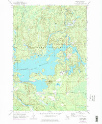
1956 Map of Kiernan
USGS Topo · Published 1977About this map
Michigamme Reservoir dominates this landscape in the Upper Peninsula, showing its status as a vital hydrological hub during the mid-20th century. The intricate shoreline of the reservoir is punctuated by the Way Dam and Hemlock Falls Dam, marking the industrial management of the Michigamme River. The surrounding Iron Range State Forest and Crystal Falls Mansfield area reflect a territory defined by timber resources and remote encampments like McMillan Camp.
Find a feature on this map
30 named features on this map. Tap any name to fly to it.
Don’t see what you’re looking for? This feature index may not catch every label — zoom into the map to look around manually.
Map Details
Editions of this 1956 Kiernan Map
4 editions found
Other maps of this area

1895 · Ned Lake
USGS Topo · 1:62,500

1899 · Sagola
USGS Topo · 1:62,500

1899 · Witbeck
USGS Topo · 1:62,500

1899 · Crystal Falls
USGS Topo · 1:62,500

1944 · Crystal Falls
USGS Topo · 1:24,000

1945 · Kelso Junction
USGS Topo · 1:24,000

1946 · Crystal Falls
USGS Topo · 1:31,680

1947 · Kiernan
USGS Topo · 1:24,000

1947 · Lake Mary
USGS Topo · 1:24,000

1947 · Kelso Junction
USGS Topo · 1:24,000