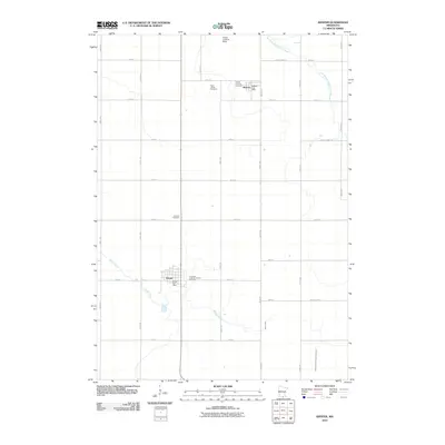
2010 Map of Kiester
USGS Topo · Published 2010About this map
Walters and Kiester anchor this corner of Faribault County, representing classic southern Minnesota agricultural settlements organized along a rigid section-line road grid. The landscape is defined by its water management, including the East Branch Blue Earth River and Brush Creek, alongside man-made improvements like Judicial Ditch Number Twentysix. These waterways and drainage systems underscore the region's historical reliance on productive farmland.
Find a feature on this map
37 named features on this map. Tap any name to fly to it.
Don’t see what you’re looking for? This feature index may not catch every label — zoom into the map to look around manually.
Map Details
Editions of this 2010 Kiester Map
This is the sole edition of this map. No revisions or reprints were ever made.
Other maps of this area

1954 · Mason City
USGS Topo · 1:250,000

1955 · Bricelyn
USGS Topo · 1:62,500

1955 · Wells
USGS Topo · 1:62,500

1957 · Mason City
USGS Topo · 1:250,000

1958 · Mason City
USGS Topo · 1:250,000

1972 · Buffalo Center NE
USGS Topo · 1:24,000

1972 · Vinje
USGS Topo · 1:24,000
1972 · Lake Mills
USGS Topo · 1:24,000
1982 · Bricelyn
USGS Topo · 1:24,000
1982 · Kiester
USGS Topo · 1:24,000