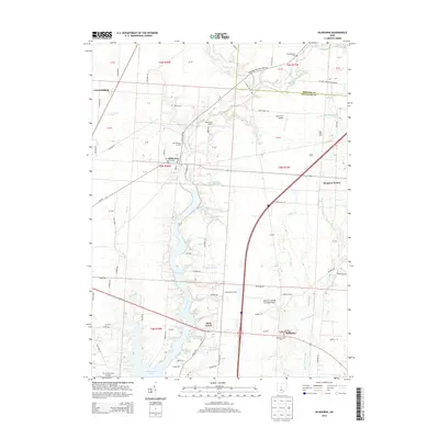
2013 Map of Kilbourne
USGS Topo · Published 2013About this map
Alum Creek carves a deep central corridor through this Delaware County landscape, feeding into the expansive Alum Creek Lake to the south. In the village of Kilbourne, the map shows a concentrated settlement pattern near the Greenmound Cem and Old Kilbourne Cem. The rural character of the region is punctuated by a series of family-named agricultural sites and private airstrips, including Shadowlake Farm, Erdy Farm Airport, and Fly-A-Way Farm Airport. To the southeast, the settlement of Berkshire sits near its namesake Berkshire Cem, while Leonardsburg occupies the northwestern corner. The topography is defined by numerous small waterways like Sugar Run and Butler Run that drain into the Alum Creek basin, illustrating the watershed's role in local land use and boundary placement.
Find a feature on this map
95 named features on this map. Tap any name to fly to it.
Don’t see what you’re looking for? This feature index may not catch every label — zoom into the map to look around manually.
Map Details
Editions of this 2013 Kilbourne Map
This is the sole edition of this map. No revisions or reprints were ever made.
Other maps of this area

1901 · Dublin
USGS Topo · 1:62,500

1902 · Westerville
USGS Topo · 1:62,500

1903 · Dublin
USGS Topo · 1:62,500

1904 · Westerville
USGS Topo · 1:62,500

1915 · Marengo
USGS Topo · 1:62,500

1924 · Delaware
USGS Topo · 1:62,500

1925 · Delaware
USGS Topo · 1:62,500

1943 · Marengo
USGS Topo · 1:62,500

1944 · Delaware
USGS Topo · 1:62,500

1950 · Marion
USGS Topo · 1:250,000