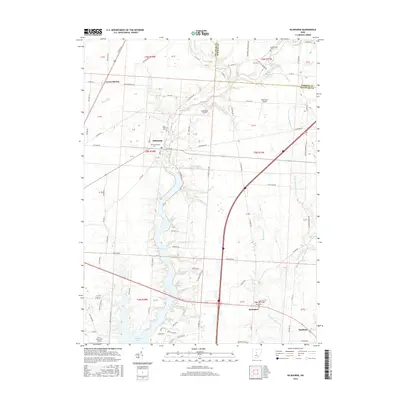
2016 Map of Kilbourne
USGS Topo · Published 2016About this map
Alum Creek winds through the heart of this central Ohio landscape, anchoring a network of drainage ways including Salt Well Run, Slate Lick, and Sugar Run. The settlement of Kilbourne sits prominently near the creek's center, while Leonardsburg and Berkshire mark the northern and southern reaches of the corridor. Several small private airfields, such as Bohannan Airport and Erdy Farm Airport, are dispersed across the terrain, reflecting the region's low-density aviation history. Genealogists will find notable value in the local cemeteries, including Old Kilbourne Cem, Greenmound Cem, and Berkshire Cem. The southern edge of the map shows the transition into more developed areas near Sunbury and the expansion of Williams Lake, highlighting the evolution of water management and residential growth along the Delaware Co and Morrow Co border.
Find a feature on this map
94 named features on this map. Tap any name to fly to it.
Don’t see what you’re looking for? This feature index may not catch every label — zoom into the map to look around manually.
Map Details
Editions of this 2016 Kilbourne Map
This is the sole edition of this map. No revisions or reprints were ever made.
Other maps of this area

1901 · Dublin
USGS Topo · 1:62,500

1902 · Westerville
USGS Topo · 1:62,500

1903 · Dublin
USGS Topo · 1:62,500

1904 · Westerville
USGS Topo · 1:62,500

1915 · Marengo
USGS Topo · 1:62,500

1924 · Delaware
USGS Topo · 1:62,500

1925 · Delaware
USGS Topo · 1:62,500

1943 · Marengo
USGS Topo · 1:62,500

1944 · Delaware
USGS Topo · 1:62,500

1950 · Marion
USGS Topo · 1:250,000