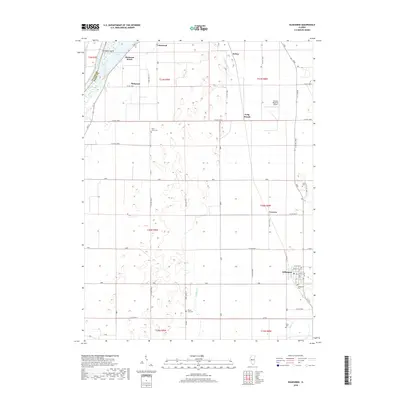
2018 Map of Kilbourne
USGS Topo · Published 2018About this map
Kilbourne serves as a primary hub for this portion of Mason County, where the street grid includes local thoroughfares like Locust St and W Poplar St. The landscape is defined by the proximity of the Illinois River, which forms a natural boundary to the northwest near Matanzas Island. Numerous small rural cemeteries are scattered across the township lines, including Saint Johns Cem and Mount Zion Cem, suggesting a long history of family homesteads in the area. Transportation and local commerce are represented by the Havana Regional Airport and several small rail-adjacent or road-junction settlements such as Conover and Lakewood. The drainage of the lowlands is visible through the winding paths of White Oak Cr and Jordan Cr, which thread between the agricultural plots and small clusters of dwellings like Matanzas Beach.
Find a feature on this map
68 named features on this map. Tap any name to fly to it.
Don’t see what you’re looking for? This feature index may not catch every label — zoom into the map to look around manually.
Map Details
Editions of this 2018 Kilbourne Map
This is the sole edition of this map. No revisions or reprints were ever made.
Other maps of this area

1925 · Havana
USGS Topo · 1:62,500

1929 · Manito
USGS Topo · 1:62,500

1930 · Chandlerville
USGS Topo · 1:62,500

1932 · Chandlerville
USGS Topo · 1:62,500

1932 · Manito
USGS Topo · 1:62,500

1933 · Petersburg
USGS Topo · 1:62,500

1938 · Petersburg
USGS Topo · 1:62,500

1947 · Havana
USGS Topo · 1:24,000

1948 · Duncan Mills
USGS Topo · 1:24,000
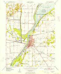
1948 · Havana
USGS Topo · 1:24,000