2024 Map of Kilbourne
USGS Topo · Published 2024About this map
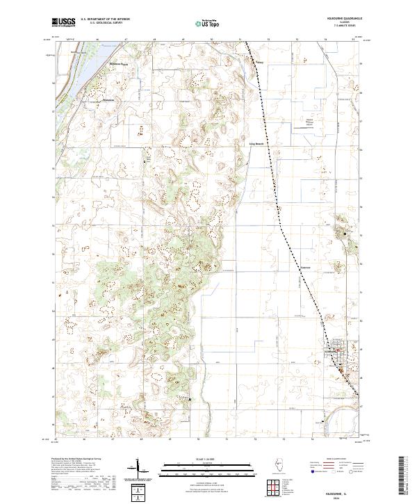
Kilbourne serves as the primary hub of this landscape in southern Mason County, situated at the intersection of rural routes and local rail history. The terrain is defined by its proximity to the Illinois River on the western edge, where Matanzas Island and the waters of Matanzas Lake create a distinct riverine environment. This 2024 survey captures a rural network of small clusters like Matanzas Beach and Conover, reflecting the agricultural and residential patterns of the Illinois River valley. For those researching family history or local land use, the map identifies several well-dispersed burial grounds, including Kilbourne Cem and the remote Saint Johns Cem. The presence of the Havana Regional Airport and drainage features like Jordan Creek further illustrate the modern management of this low-lying, water-adjacent prairie region.
Find a feature on this map
34 named features on this map. Tap any name to fly to it.
Don’t see what you’re looking for? This feature index may not catch every label — zoom into the map to look around manually.
Map Details
Editions of this 2024 Kilbourne Map
This is the sole edition of this map. No revisions or reprints were ever made.