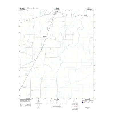
2012 Map of Kilbourne
USGS Topo · Published 2012About this map
Kilbourne sits at the northern edge of this Louisiana landscape, where the local road network centers on the town's School St and Cemetery St. The area's geography is defined by a dense system of waterways, most notably the winding course of Bayou Macon, which is joined by tributaries like Tiger Bayou and Hill Bayou. These bayous create a distinctive drainage pattern across the agricultural land, influencing the placement of settlements and crossings such as Ashton Bridge in the northeast.
Find a feature on this map
76 named features on this map. Tap any name to fly to it.
Don’t see what you’re looking for? This feature index may not catch every label — zoom into the map to look around manually.
Map Details
Editions of this 2012 Kilbourne Map
This is the sole edition of this map. No revisions or reprints were ever made.
Other maps of this area

1909 · Baxter Bayou
USGS Topo · 1:24,000

1909 · Lake Providence
USGS Topo · 1:24,000

1909 · Millikin
USGS Topo · 1:24,000

1909 · Ashton Bridge
USGS Topo · 1:24,000

1911 · Lake Providence
USGS Topo · 1:31,680

1911 · Baxter Bayou
USGS Topo · 1:24,000

1912 · Ashton Bridge
USGS Topo · 1:31,680

1914 · Baxter Bayou
USGS Topo · 1:31,680

1935 · Oak Grove
USGS Topo · 1:62,500

1936 · Eudora
USGS Topo · 1:62,500