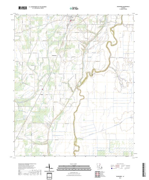
2024 Map of Kilbourne
USGS Topo · Published 2024About this map
Bayou Macon winds along the boundary between West Carroll Parish and East Carroll Parish, defining a landscape where agriculture meets the drainage network of the Mississippi River Delta. The small community of Kilbourne serves as a northern hub, anchored by streets such as Railroad St and Cemetery St that hint at the town's historical foundations. To the south, the settlements of Chickasaw and Terry are situated along the transit lines that parallel the bayou, surrounded by a dense grid of parish roads that provide access to the fertile lowlands. The geography is characterized by numerous slow-moving water bodies, including Tiger Bayou, Wilson Bayou, and Coleman Bayou, which carve through the terrain. A network of rural routes like Hill Church Rd and Chickasaw Loop connect isolated family lands and local gathering points within this traditional Louisiana agricultural corridor.
Find a feature on this map
72 named features on this map. Tap any name to fly to it.
Don’t see what you’re looking for? This feature index may not catch every label — zoom into the map to look around manually.
Map Details
Editions of this 2024 Kilbourne Map
This is the sole edition of this map. No revisions or reprints were ever made.
Other maps of this area

1909 · Baxter Bayou
USGS Topo · 1:24,000

1909 · Lake Providence
USGS Topo · 1:24,000

1909 · Millikin
USGS Topo · 1:24,000

1909 · Ashton Bridge
USGS Topo · 1:24,000

1911 · Lake Providence
USGS Topo · 1:31,680

1911 · Baxter Bayou
USGS Topo · 1:24,000

1912 · Ashton Bridge
USGS Topo · 1:31,680

1914 · Baxter Bayou
USGS Topo · 1:31,680

1935 · Oak Grove
USGS Topo · 1:62,500

1936 · Eudora
USGS Topo · 1:62,500