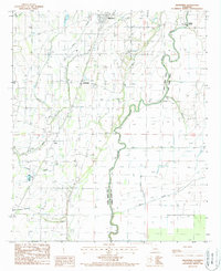
1988 Map of Kilbourne
USGS Topo · Published 1988About this map
The winding course of Macon Bayou defines the eastern boundary of West Carroll Parish in this 1980s landscape. This survey captures a rural agricultural economy reliant on sophisticated water management, as evidenced by an Irrigation Lift Pump, several Spoil Banks, and a Levee system. The settlement of Kilbourne serves as the local hub, while smaller clusters like Chickasaw, Terry, and Coleman dot the grid. Transportation history is visible through the Old Railroad Grade cutting north-south across the bayous, marking a shift from rail-based commerce to road and air, the latter represented by a local Landing Strip. The network of water bodies, including Tiger Bayou and Little Colewa Bayou, underscores the low-lying, alluvial nature of the Mississippi Delta region during this era.
Find a feature on this map
25 named features on this map. Tap any name to fly to it.
Don’t see what you’re looking for? This feature index may not catch every label — zoom into the map to look around manually.
Map Details
Editions of this 1988 Kilbourne Map
This is the sole edition of this map. No revisions or reprints were ever made.
Other maps of this area

1909 · Baxter Bayou
USGS Topo · 1:24,000

1909 · Lake Providence
USGS Topo · 1:24,000

1909 · Millikin
USGS Topo · 1:24,000

1909 · Ashton Bridge
USGS Topo · 1:24,000

1911 · Lake Providence
USGS Topo · 1:31,680

1911 · Baxter Bayou
USGS Topo · 1:24,000

1912 · Ashton Bridge
USGS Topo · 1:31,680

1914 · Baxter Bayou
USGS Topo · 1:31,680

1935 · Oak Grove
USGS Topo · 1:62,500

1936 · Eudora
USGS Topo · 1:62,500