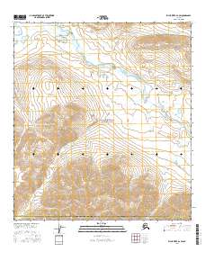
2016 Map of Killik River A-2 SW
USGS Topo · Published 2016About this map
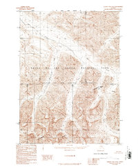
Gates Of The Arctic National Park encompasses the majority of this Arctic landscape, where the high-altitude headwaters of several drainages meet at the border of the North Slope Borough Yukon-Koyukuk Census Area. The terrain is defined by its complex network of seasonal and perennial streams, most notably the Killik River and the small, alpine Lake Tutitlik. This area serves as a significant drainage divide for the Brooks Range, with water flowing through systems like Easter Creek and Suluak Cr. The survey details the topographic contours of these uninhabited valleys, showing how the ridges separate the north-flowing Kanongiksuk Cr from other southern-bound tributaries. Without roads or permanent settlements, the map focuses on the hydrography and elevation of this interior wilderness, providing a clear view of the natural corridors used for navigation through these mountain passes.
Find a feature on this map
20 named features on this map. Tap any name to fly to it.
Don’t see what you’re looking for? This feature index may not catch every label — zoom into the map to look around manually.
Map Details
Editions of this 2016 Killik River A-2 SW Map
This is the sole edition of this map. No revisions or reprints were ever made.
Other maps of this area

1951 · Survey Pass
USGS Topo · 1:250,000

1951 · Killik River
USGS Topo · 1:250,000

1956 · Survey Pass
USGS Topo · 1:250,000

1956 · Killik River
USGS Topo · 1:250,000

1964 · Survey Pass
USGS Topo · 1:250,000

1966 · Survey Pass
USGS Topo · 1:250,000
1986 · Killik River A-2
USGS Topo · 1:63,360
1986 · Killik River A-3
USGS Topo · 1:63,360
1986 · Survey Pass D-2
USGS Topo · 1:63,360
1986 · Survey Pass D-3
USGS Topo · 1:63,360