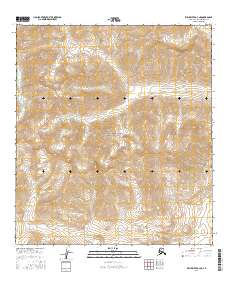
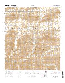
2016 Map of Killik River A-3 NE
USGS Topo · Published 2016About this map
Gates of the Arctic National Park dominates this remote Arctic landscape, representing a vast expanse of protected wilderness in the North Slope Borough. The terrain is defined by its drainage systems, most notably the winding paths of Enekalikruak Cr and Sugakuk Cr, which carve through the high-elevation contours of the central and southern portions of the sheet. In the northeast corner, Iritik Cr emerges, signaling the start of another watershed. The map provides a high-resolution 2016 view of this uninhabited region, where the absence of roads or permanent structures highlights the purely topographical and hydrological character of the Brooks Range foothills. Researchers of northern geography can trace the intricate Public Land Survey System grid, including boundaries for t33n r19e and t32n r20e, overlaid across the complex mountain relief.
Find a feature on this map
8 named features on this map. Tap any name to fly to it.
Don’t see what you’re looking for? This feature index may not catch every label — zoom into the map to look around manually.
Map Details
Editions of this 2016 Killik River A-3 NE Map
This is the sole edition of this map. No revisions or reprints were ever made.
Other maps of this area

1951 · Killik River
USGS Topo · 1:250,000

1956 · Killik River
USGS Topo · 1:250,000
1986 · Killik River A-2
USGS Topo · 1:63,360
1986 · Killik River B-2
USGS Topo · 1:63,360
1986 · Killik River A-3
USGS Topo · 1:63,360
1986 · Killik River B-3
USGS Topo · 1:63,360
2016 · Killik River A-2 NW
USGS Topo · 1:25,000
2016 · Killik River B-3 SW
USGS Topo · 1:25,000
2016 · Killik River A-3 NW
USGS Topo · 1:25,000
2016 · Killik River B-3 SE
USGS Topo · 1:25,000