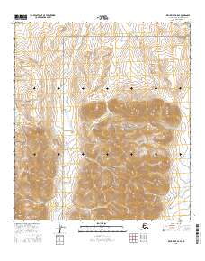
2016 Map of Killik River B-5 SE
USGS Topo · Published 2016About this map
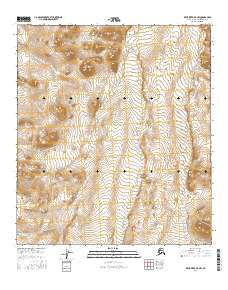
Gates of the Arctic National Park encompasses much of this remote Alaskan terrain, where high-elevation contours define a landscape of steep ridges and deep valleys. The drainage system is dominated by the Iivoluk Cr, which runs northward through the center of the sheet, and the E Fork Etivluk River cutting across the southeastern corner. This 2016 survey illustrates the pristine state of the Brooks Range foothills, showing the topographic complexity of the northern slope without any roads or human settlements. The map's detailed elevation data reveals the source waters for the Arctic watershed, including Otuk Cr in the west, providing a precise record of this wilderness area for conservationists and environmental researchers.
Find a feature on this map
10 named features on this map. Tap any name to fly to it.
Don’t see what you’re looking for? This feature index may not catch every label — zoom into the map to look around manually.
Map Details
Editions of this 2016 Killik River B-5 SE Map
This is the sole edition of this map. No revisions or reprints were ever made.
Other maps of this area

1951 · Killik River
USGS Topo · 1:250,000

1956 · Killik River
USGS Topo · 1:250,000
1984 · Killik River B-5
USGS Topo · 1:63,360
1984 · Killik River A-5
USGS Topo · 1:63,360
1986 · Killik River A-4
USGS Topo · 1:63,360
1986 · Killik River B-4
USGS Topo · 1:63,360
2016 · Killik River B-4 SW
USGS Topo · 1:25,000
2016 · Killik River B-4 NW
USGS Topo · 1:25,000
2016 · Killik River B-5 NE
USGS Topo · 1:25,000
2016 · Killik River B-5 NW
USGS Topo · 1:25,000