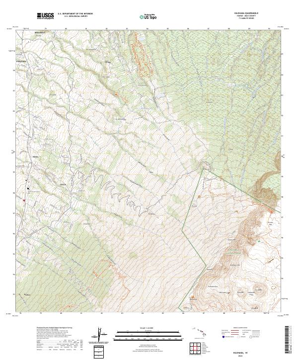
2024 Map of Kilohana
USGS Topo · Published 2024About this map
Haleakalā National Park and the adjacent Haleakalā Wilderness dominate the southeastern quadrant of this Maui landscape, where the terrain rises toward the massive volcanic crater. The upcountry communities of Makawao, Pukalani, and Kula are situated along the lower western slopes, defined by a dense network of local roads such as Kekaulike Ave and Lower Kula Rd. This area reflects the residential and agricultural transition between the coast and the high elevation interior, with landmarks like the Holy Ghost Church Catholic and its nearby Cem serving as long-standing local anchors.
Find a feature on this map
112 named features on this map. Tap any name to fly to it.
Don’t see what you’re looking for? This feature index may not catch every label — zoom into the map to look around manually.
Map Details
Editions of this 2024 Kilohana Map
This is the sole edition of this map. No revisions or reprints were ever made.
Other maps of this area

1954 · Maui
USGS Topo · 1:250,000

1954 · Paia
USGS Topo · 1:24,000

1954 · Puu O Kali
USGS Topo · 1:24,000

1954 · Makena
USGS Topo · 1:24,000

1957 · Kilohana
USGS Topo · 1:24,000

1957 · Haiku
USGS Topo · 1:24,000

1957 · Lualailua Hills
USGS Topo · 1:24,000

1957 · Nahiku
USGS Topo · 1:24,000

1957 · Kaupo
USGS Topo · 1:24,000

1957 · Keanae
USGS Topo · 1:24,000