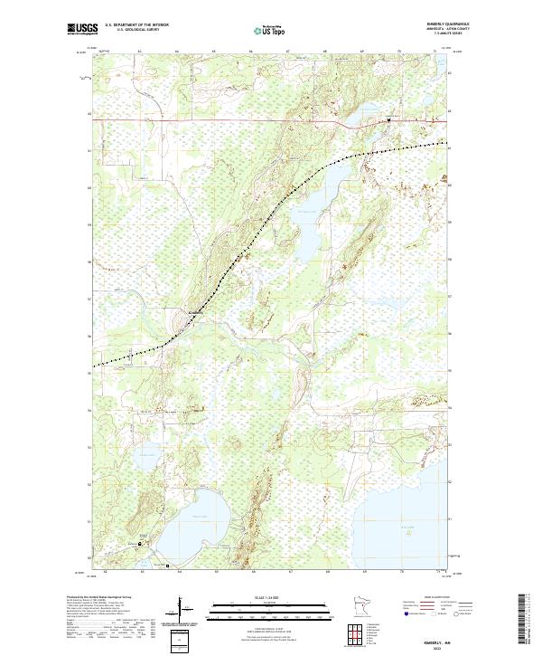
2022 Map of Kimberly
USGS Topo · Published 2022About this map
The Kimberly settlement serves as a central point in this Aitkin County landscape, where the meandering Rice River and Dam Brook cut through a territory heavily defined by its glacial hydrology. The area is dense with interconnected water bodies, from the central Portage Lake to the large expanses of Dam Lake and Rice Lake in the southern reaches. This modern survey reflects a region where local heritage is preserved in several small burial grounds, including the Lansford Cem near Turner Lake and the Howard Private Cem further south.
Find a feature on this map
43 named features on this map. Tap any name to fly to it.
Don’t see what you’re looking for? This feature index may not catch every label — zoom into the map to look around manually.
Map Details
Editions of this 2022 Kimberly Map
This is the sole edition of this map. No revisions or reprints were ever made.
Other maps of this area

1914 · Aitkin
USGS Topo · 1:62,500

1915 · Aitkin
USGS Topo · 1:62,500

1916 · Wealthwood
USGS Topo · 1:62,500

1953 · Duluth
USGS Topo · 1:250,000

1958 · Duluth
USGS Topo · 1:250,000

1969 · Thor NE
USGS Topo · 1:24,000

1969 · Thor
USGS Topo · 1:24,000

1970 · Kimberly
USGS Topo · 1:24,000

1970 · Mc Gregor
USGS Topo · 1:24,000

1970 · Palisade
USGS Topo · 1:24,000