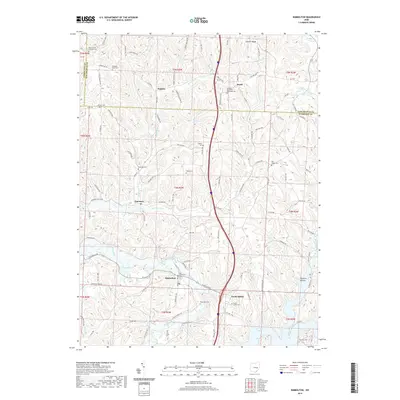
2019 Map of Kimbolton
USGS Topo · Published 2019About this map
The Kimbolton village area and the surrounding rural landscape of Guernsey County are defined by the winding course of Wills Creek and the southern reaches of Salt Fork Lake. This modern topographic survey highlights a network of small settlements and historical burial grounds that speak to the region's long-established community roots, including the Old Kimbolton Cem and the Peoples Methodist Episcopal Cem near Booth. The terrain transitions from the elevated Stocker Ridge in the north to the more frequent valley floors carved by the Johnson Fork and Birds Run. Small-scale features such as Bishard Pond and the church-affiliated Saint Jacobs Lutheran Cem are meticulously recorded, alongside the major north-south corridor of Interstate 77 which now cuts through these historic township lands. Local genealogists will find value in the precise location of family-named sites like Painters Hollow and numerous rural cemeteries like Flat Ridge Cem and North Salem Cem.
Find a feature on this map
117 named features on this map. Tap any name to fly to it.
Don’t see what you’re looking for? This feature index may not catch every label — zoom into the map to look around manually.
Map Details
Editions of this 2019 Kimbolton Map
This is the sole edition of this map. No revisions or reprints were ever made.
Other maps of this area

1909 · Antrim
USGS Topo · 1:48,000

1909 · Uhrichsville
USGS Topo · 1:62,500

1909 · Cambridge
USGS Topo · 1:62,500

1911 · Antrim
USGS Topo · 1:62,500

1911 · Uhrichsville
USGS Topo · 1:62,500

1911 · Newcomerstown
USGS Topo · 1:62,500

1912 · Cambridge
USGS Topo · 1:62,500

1913 · Newcomerstown
USGS Topo · 1:62,500

1943 · Newcomerstown
USGS Topo · 1:62,500

1951 · Canton
USGS Topo · 1:250,000