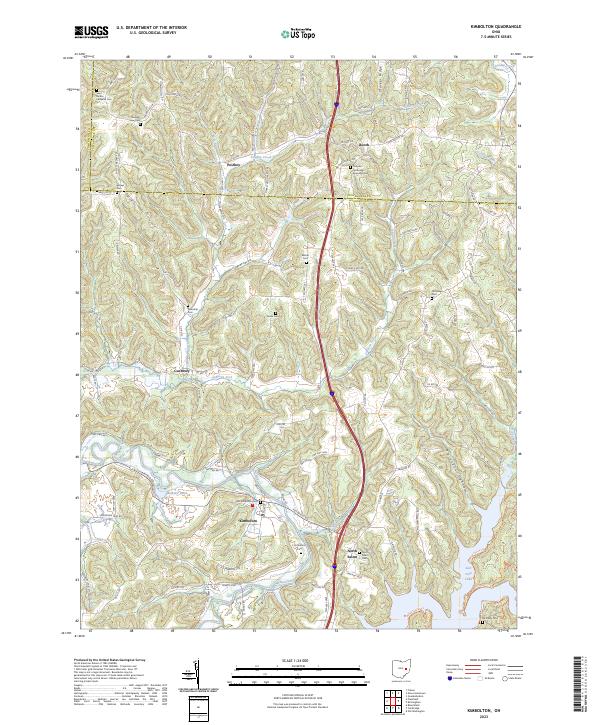
2023 Map of Kimbolton
USGS Topo · Published 2023About this map
Kimbolton and the surrounding townships of Guernsey, Tuscarawas, and Coshocton Counties are characterized by a rugged network of ridges and winding stream valleys. The village of Kimbolton sits at a low point near the banks of Wills Creek, surrounded by a high density of early burial grounds that speak to the long settlement history of this valley. Notable sites include the Old Kimbolton Cem and Saint Jacobs Lutheran Cem, while nearby North Salem and Guernsey mark traditional centers of local commerce and community life. The landscape is defined by the significant corridor of Wills Creek and the southern reach of Salt Fork Lake. High points such as Stocker Ridge and the secluded Pointers Hollow offer a clear picture of the area's complex topography. This survey provides a modern look at the rural road network, from township routes to major thoroughfares like Post Boy Rd, while preserving the locations of numerous country churches and family-named cemeteries.
Find a feature on this map
101 named features on this map. Tap any name to fly to it.
Don’t see what you’re looking for? This feature index may not catch every label — zoom into the map to look around manually.
Map Details
Editions of this 2023 Kimbolton Map
This is the sole edition of this map. No revisions or reprints were ever made.
Other maps of this area

1909 · Antrim
USGS Topo · 1:48,000

1909 · Uhrichsville
USGS Topo · 1:62,500

1909 · Cambridge
USGS Topo · 1:62,500

1911 · Antrim
USGS Topo · 1:62,500

1911 · Uhrichsville
USGS Topo · 1:62,500

1911 · Newcomerstown
USGS Topo · 1:62,500

1912 · Cambridge
USGS Topo · 1:62,500

1913 · Newcomerstown
USGS Topo · 1:62,500

1943 · Newcomerstown
USGS Topo · 1:62,500

1951 · Canton
USGS Topo · 1:250,000