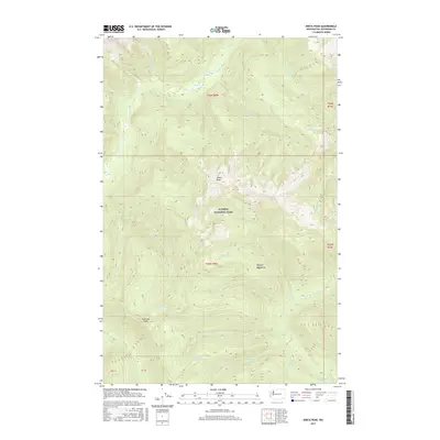
2017 Map of Kimta Peak
USGS Topo · Published 2017About this map
Kimta Peak stands as the centerpiece of this high-elevation interior landscape within Olympic National Park. This portion of the Olympic Mountains is defined by a dense network of watercourses and steep ridges that feed two major drainage systems. To the north, the Queets River and its tributaries like Kilkelly Cr and Hee-Hee Cr carve through the terrain, while the southern slopes descend toward the N Fork Quinault River. This 2017 survey reveals a remote wilderness where travel is dictated by the massive landforms of Tshletshy Ridge. Small, isolated alpine bodies of water including Lake Beauty, Kurtz Lake, and the Three Prune Lakes are scattered across the high basins, marking the sources of creeks like Kimta Cr and Promise Cr.
Find a feature on this map
26 named features on this map. Tap any name to fly to it.
Don’t see what you’re looking for? This feature index may not catch every label — zoom into the map to look around manually.
Map Details
Editions of this 2017 Kimta Peak Map
This is the sole edition of this map. No revisions or reprints were ever made.
Other maps of this area

1935 · Mount Olympus
USGS Topo · 1:62,500

1939 · Mount Tom
USGS Topo · 1:62,500

1942 · Mount Olympus
USGS Topo · 1:62,500

1947 · Mt Christie
USGS Topo · 1:62,500

1950 · Mt Christie
USGS Topo · 1:62,500

1956 · Mount Olympus
USGS Topo · 1:62,500

1956 · Kloochman Rock
USGS Topo · 1:62,500

1956 · Mount Tom
USGS Topo · 1:62,500
1957 · Mount Tom
USGS Topo · 1:62,500

1958 · Seattle
USGS Topo · 1:250,000