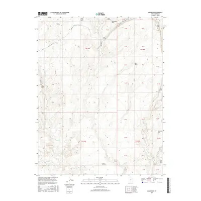
2017 Map of King Bench
USGS Topo · Published 2017About this map
Moab to Boulder Town Burr Trl winds through this high-desert landscape in Garfield County, following a historic route that connected isolated settlements across some of Utah’s most formidable terrain. The southern portion of the map is defined by the Escalante River, which carves through the sandstone alongside Brigham Tea Bench and Halfway Hollow. To the north, the geography rises into a series of distinctive plateaus including King Bench, Rattlesnake Bench, and Steep Creek Bench. These features reflect a land shaped by deep erosion, where watercourses like Boulder Cr and Wolverine Cr have cut significant drainages into the Circle Cliffs. The map illustrates the complex drainage patterns feeding into the Escalante system, documenting the natural landmarks and remote corridors that have guided travelers and ranchers through the region for generations.
Find a feature on this map
43 named features on this map. Tap any name to fly to it.
Don’t see what you’re looking for? This feature index may not catch every label — zoom into the map to look around manually.
Map Details
Editions of this 2017 King Bench Map
This is the sole edition of this map. No revisions or reprints were ever made.
Other maps of this area

1886 · Escalante
USGS Topo · 1:250,000

1953 · Circle Cliffs 2 NE
USGS Topo · 1:24,000

1953 · Circle Cliffs 4 NW
USGS Topo · 1:24,000

1953 · Circle Cliffs 1 SW
USGS Topo · 1:24,000
1953 · Circle Cliffs 1 NW
USGS Topo · 1:24,000

1953 · Moody Creek
USGS Topo · 1:62,500
1953 · Wagon Box Mesa
USGS Topo · 1:62,500

1956 · Escalante
USGS Topo · 1:250,000

1960 · Escalante
USGS Topo · 1:250,000

1964 · Tenmile Flat
USGS Topo · 1:24,000