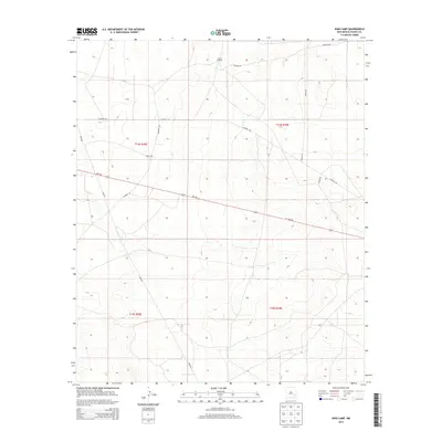
2013 Map of King Camp
USGS Topo · Published 2013About this map
King Camp and the Anchor D Ranch serve as the primary landmarks in this high-plains landscape of Chaves County. This 2013 survey documents a remote section of New Mexico characterized by a structured grid of local access roads such as Consuelo Rd, Suzanne Rd, and Katrina Rd. The area is bisected by a significant pipeline corridor running north-south, highlighting the industrial infrastructure that shares the land with traditional ranching operations. The primary transportation artery is Nm-249, which cuts diagonally across the township lines of t14s r28e and t14s r29e. The map captures the intersection of energy transport and rural land management, where named roads like Teresa Rd and Jemina Rd provide the only breaks in the arid terrain.
Find a feature on this map
13 named features on this map. Tap any name to fly to it.
Don’t see what you’re looking for? This feature index may not catch every label — zoom into the map to look around manually.
Map Details
Editions of this 2013 King Camp Map
This is the sole edition of this map. No revisions or reprints were ever made.
Other maps of this area

1951 · Ninemile Well
USGS Topo · 1:24,000

1951 · King Camp
USGS Topo · 1:24,000

1951 · Diamond Mound
USGS Topo · 1:24,000

1952 · Connor Well
USGS Topo · 1:24,000

1952 · Bar C Bar Ranch
USGS Topo · 1:24,000

1953 · Basin Well
USGS Topo · 1:24,000

1954 · Carlsbad
USGS Topo · 1:250,000

1954 · Hobbs
USGS Topo · 1:250,000

1954 · Brownfield
USGS Topo · 1:250,000

1955 · Roswell
USGS Topo · 1:250,000