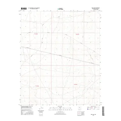
2017 Map of King Camp
USGS Topo · Published 2017About this map
King Camp and the surrounding ranchlands of Chaves County are defined by a sparse network of roads and isolated water sources necessary for cattle operations in the High Plains. This 2017 survey shows a landscape organized by section lines and long-distance thoroughfares like Aberdeen Rd and Katrina Rd. Notable landmarks include named features such as Diamond Mound and Cedar Point, which rise above the surrounding terrain. The presence of several established wells and camps, such as Connor Well, Basin Well, and Vest Camp, indicates the continued importance of livestock infrastructure. Ranching heritage is further cemented by the prominent 1 Bar C Bar Ranch and the localized collection of tanks like Henshaw Tank.
Find a feature on this map
26 named features on this map. Tap any name to fly to it.
Don’t see what you’re looking for? This feature index may not catch every label — zoom into the map to look around manually.
Map Details
Editions of this 2017 King Camp Map
This is the sole edition of this map. No revisions or reprints were ever made.
Other maps of this area

1951 · Ninemile Well
USGS Topo · 1:24,000

1951 · King Camp
USGS Topo · 1:24,000

1951 · Diamond Mound
USGS Topo · 1:24,000

1952 · Connor Well
USGS Topo · 1:24,000

1952 · Bar C Bar Ranch
USGS Topo · 1:24,000

1953 · Basin Well
USGS Topo · 1:24,000

1954 · Carlsbad
USGS Topo · 1:250,000

1954 · Hobbs
USGS Topo · 1:250,000

1954 · Brownfield
USGS Topo · 1:250,000

1955 · Roswell
USGS Topo · 1:250,000