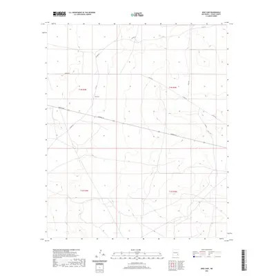
2020 Map of King Camp
USGS Topo · Published 2020About this map
King Camp occupies a central position within this section of Chaves County, serving as a focal point for a network of local roads that traverse the high plains. The landscape is defined by its systematic organization, divided into townships and ranges such as t14s r28e and t14s r29e. This 2020 survey illustrates a contemporary rural environment where transportation routes like Aberdeen Rd and Katrina Rd provide the primary infrastructure for the region. The sparse distribution of named locations suggests a quiet, open-country character, where individual roads like Suzanne Rd and Teresa Rd mark the few established pathways through the terrain. Researchers can observe how the modern road numbering system, including Co Rd 25 and Co Rd 165, integrates with older named routes to facilitate movement across this expansive part of New Mexico.
Find a feature on this map
13 named features on this map. Tap any name to fly to it.
Don’t see what you’re looking for? This feature index may not catch every label — zoom into the map to look around manually.
Map Details
Editions of this 2020 King Camp Map
This is the sole edition of this map. No revisions or reprints were ever made.
Other maps of this area

1951 · Ninemile Well
USGS Topo · 1:24,000

1951 · King Camp
USGS Topo · 1:24,000

1951 · Diamond Mound
USGS Topo · 1:24,000

1952 · Connor Well
USGS Topo · 1:24,000

1952 · Bar C Bar Ranch
USGS Topo · 1:24,000

1953 · Basin Well
USGS Topo · 1:24,000

1954 · Carlsbad
USGS Topo · 1:250,000

1954 · Hobbs
USGS Topo · 1:250,000

1954 · Brownfield
USGS Topo · 1:250,000

1955 · Roswell
USGS Topo · 1:250,000