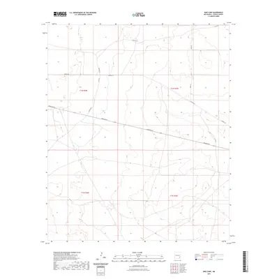
2023 Map of King Camp
USGS Topo · Published 2023About this map
The arid landscape of eastern Chaves County is defined by a sparse but deliberate network of ranch roads and survey boundaries. Land management dominates the area, with the terrain partitioned into sections under t14s r28e, t14s r29e, t15s r28e, and t15s r29e. These townships represent the fundamental legal geography of the High Plains, where human presence is marked by long, straight thoroughfares such as Aberdeen Rd. Connectivity across the rangeland depends on a series of local tracks including Suzanne Rd, Katrina Rd, and Teresa Rd. The absence of dense settlements or perennial water bodies on this map underscores the vastness of the New Mexico interior, where the primary infrastructure serves the needs of isolated ranching operations and public land administration.
Find a feature on this map
12 named features on this map. Tap any name to fly to it.
Don’t see what you’re looking for? This feature index may not catch every label — zoom into the map to look around manually.
Map Details
Editions of this 2023 King Camp Map
This is the sole edition of this map. No revisions or reprints were ever made.
Other maps of this area

1951 · Ninemile Well
USGS Topo · 1:24,000

1951 · King Camp
USGS Topo · 1:24,000

1951 · Diamond Mound
USGS Topo · 1:24,000

1952 · Connor Well
USGS Topo · 1:24,000

1952 · Bar C Bar Ranch
USGS Topo · 1:24,000

1953 · Basin Well
USGS Topo · 1:24,000

1954 · Carlsbad
USGS Topo · 1:250,000

1954 · Hobbs
USGS Topo · 1:250,000

1954 · Brownfield
USGS Topo · 1:250,000

1955 · Roswell
USGS Topo · 1:250,000