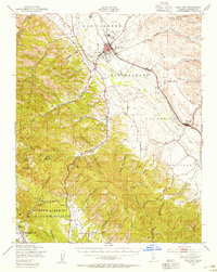
1948 Map of King City
USGS Topo · Published 1955About this map
The Salinas River valley in the late 1940s is defined by the sharp contrast between the irrigated agricultural floor and the sprawling canyons of the southern Coast Ranges. King City serves as the primary hub, where the Southern Pacific railroad and the King City Airport anchor the local economy. Southward, the map details the rugged territory within the Hunter Liggett Military Reservation, containing the Hunter Liggett Headquarters and the historic San Antonio Mission. This era of the reservation shows a complex network of internal roads like Telephone Road and Jolon Road, alongside remote outposts such as Argyle. The landscape is etched with dozens of named drainages, from Wildhorse Canyon to Espinosa Canyon, illustrating the challenging terrain that shaped both cattle ranching and military training operations in Monterey County.
Find a feature on this map
57 named features on this map. Tap any name to fly to it.
Don’t see what you’re looking for? This feature index may not catch every label — zoom into the map to look around manually.
Map Details
Editions of this 1948 King City Map
2 editions found
Other maps of this area

1912 · San Ardo
USGS Topo · 1:31,680

1912 · Metz
USGS Topo · 1:31,680

1915 · Soledad
USGS Topo · 1:62,500

1915 · Priest Valley
USGS Topo · 1:125,000

1919 · King City
USGS Topo · 1:62,500

1919 · Junipero Serra
USGS Topo · 1:62,500

1919 · Bryson
USGS Topo · 1:62,500

1919 · Bradley
USGS Topo · 1:62,500

1921 · Cape San Martin
USGS Topo · 1:62,500

1921 · Metz
USGS Topo · 1:62,500