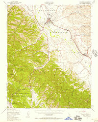
1948 Map of King City
USGS Topo · Published 1958About this map
Salinas River serves as the central artery for this late-1940s landscape, flanked by the sprawling Hunter Liggett Military Reservation and the industrial activity of the Southern Pacific railroad. The agricultural heart of the Salinas Valley is anchored by King City, where the King City Airport and local infrastructure like the Sewage Disposal plant reflect postwar development. To the south, the terrain transitions into a dense network of canyons, including Quinado Canyon and Espinosa Canyon, leading toward the storied San Antonio Mission and the Hunter Liggett Headquarters at the map's edge.
Find a feature on this map
53 named features on this map. Tap any name to fly to it.
Don’t see what you’re looking for? This feature index may not catch every label — zoom into the map to look around manually.
Map Details
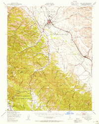
Editions of this 1948 King City Map
2 editions found
Other maps of this area

1912 · San Ardo
USGS Topo · 1:31,680

1912 · Metz
USGS Topo · 1:31,680

1915 · Soledad
USGS Topo · 1:62,500

1915 · Priest Valley
USGS Topo · 1:125,000

1919 · King City
USGS Topo · 1:62,500

1919 · Junipero Serra
USGS Topo · 1:62,500

1919 · Bryson
USGS Topo · 1:62,500

1919 · Bradley
USGS Topo · 1:62,500

1921 · Cape San Martin
USGS Topo · 1:62,500

1921 · Metz
USGS Topo · 1:62,500