
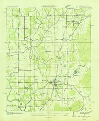
1936 Map of King Cove
USGS Topo · Published 1936About this map
Cumberland Mountain dominates the landscape of this 1936 survey, where the borders of Madison and Jackson counties meet the Tennessee-Alabama state line. The map illustrates a rural highland economy defined by isolated coves and scattered community focal points. Local life is centered around family-named features and small institutions such as Beech Grove Ch and Howard Hill Sch.
Find a feature on this map
40 named features on this map. Tap any name to fly to it.
Don’t see what you’re looking for? This feature index may not catch every label — zoom into the map to look around manually.
Map Details
Editions of this 1936 King Cove Map
This is the sole edition of this map. No revisions or reprints were ever made.
Other maps of this area

1888 · Scottsboro
USGS Topo · 1:125,000

1892 · Scottsboro
USGS Topo · 1:125,000

1928 · Decherd
USGS Topo · 1:62,500

1936 · Flintville
USGS Topo · 1:24,000

1936 · Hollytree
USGS Topo · 1:24,000

1936 · Beans Creek
USGS Topo · 1:24,000

1936 · Princeton
USGS Topo · 1:24,000

1936 · Huntland
USGS Topo · 1:24,000

1936 · Maysville
USGS Topo · 1:24,000
1936 · New Market
USGS Topo · 1:24,000