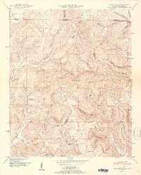
1951 Map of King Cove
USGS Topo · Published 1951About this map
Putman Mountain and Maxwell Mountain dominate this landscape along the state line where Tennessee and Alabama meet. The 1951 geography is defined by isolated coves and hollows, such as King Cove and Puncheon Cove, which dictated the pattern of early upland settlement. Small community centers like Francisco in the northeast corner and The Dugout further south served as anchors for a network of rural homesteads and family burial grounds.
Find a feature on this map
63 named features on this map. Tap any name to fly to it.
Don’t see what you’re looking for? This feature index may not catch every label — zoom into the map to look around manually.
Map Details
Editions of this 1951 King Cove Map
2 editions found
Other maps of this area

1888 · Scottsboro
USGS Topo · 1:125,000

1892 · Scottsboro
USGS Topo · 1:125,000

1928 · Decherd
USGS Topo · 1:62,500

1936 · King Cove
USGS Topo · 1:24,000

1936 · Flintville
USGS Topo · 1:24,000

1936 · Hollytree
USGS Topo · 1:24,000

1936 · Beans Creek
USGS Topo · 1:24,000

1936 · Princeton
USGS Topo · 1:24,000

1936 · Huntland
USGS Topo · 1:24,000

1936 · Maysville
USGS Topo · 1:24,000