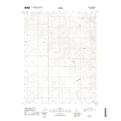
2020 Map of King Top
USGS Topo · Published 2020About this map
King Top rises as a prominent landmark within the Confusion Range in Millard County, defining a landscape shaped by significant topographic relief and intricate drainage systems. This 2020 survey illustrates a complex network of canyons that carve through the high desert terrain, including Bonny Stairs Canyon to the north and the expansive Cedar Canyon further south. The nomenclature of the area reflects the diverse geological features and historical naming conventions of the region, from the descriptive Red Ledges Canyon to the uniquely named Noddy Canyon. The lack of modern development or permanent settlements within this quadrangle emphasizes the remote and undisturbed character of this portion of Western Utah, where the terrain itself remains the primary focus of the map. Researchers can examine the precise contouring of features like Burnout Canyon and Smooth Canyon, which illustrate the erosion patterns characteristic of the Great Basin.
Find a feature on this map
11 named features on this map. Tap any name to fly to it.
Don’t see what you’re looking for? This feature index may not catch every label — zoom into the map to look around manually.
Map Details
Editions of this 2020 King Top Map
This is the sole edition of this map. No revisions or reprints were ever made.
Other maps of this area

1908 · Fish Springs
USGS Topo · 1:250,000

1910 · Fish Springs
USGS Topo · 1:250,000

1953 · Richfield
USGS Topo · 1:250,000

1953 · Delta
USGS Topo · 1:250,000

1958 · Richfield
USGS Topo · 1:250,000

1958 · Delta
USGS Topo · 1:250,000

1960 · Notch Peak
USGS Topo · 1:62,500

1960 · Crystal Peak
USGS Topo · 1:62,500

1960 · Conger Mountain
USGS Topo · 1:62,500

1960 · The Barn
USGS Topo · 1:62,500