
1920 Map of King William
USGS Topo · Published 1920About this map
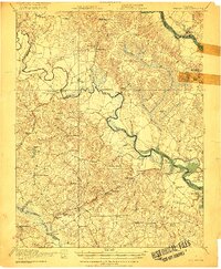
The Pamunkey River winds through the heart of this coastal plain landscape, defining the boundaries of tidal swamps and early Tidewater infrastructure. The Pamunkey Indian Reservation occupies a prominent bend in the river near Lilly Point, while river crossings like the Piping Tree Ferry and Newcastle Bridge underscore the area's reliance on waterborne transport and traditional ferries. The regional economy is anchored by numerous mills, including Dabneys Mill and Putneys Mill, alongside the Southern Railway corridor through Tunstall and White House.
Find a feature on this map
69 named features on this map. Tap any name to fly to it.
Don’t see what you’re looking for? This feature index may not catch every label — zoom into the map to look around manually.
Map Details
Editions of this 1920 King William Map
4 editions found
Other maps of this area

1894 · Bermuda Hundred
USGS Topo · 1:62,500

1894 · Richmond
USGS Topo · 1:62,500

1895 · Richmond
USGS Topo · 1:62,500

1917 · Toano
USGS Topo · 1:62,500

1918 · Charles City
USGS Topo · 1:62,500

1918 · Toano
USGS Topo · 1:62,500

1918 · Doswell
USGS Topo · 1:62,500

1918 · Tappahannock
USGS Topo · 1:62,500

1918 · Aylett
USGS Topo · 1:62,500

1919 · New Kent
USGS Topo · 1:62,500