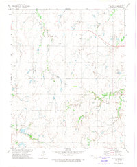
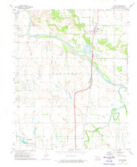
1972 Map of Kingfisher SE
USGS Topo · Published 1974About this map
Reeding serves as the primary focal point for this rural Oklahoma landscape, which is marked by a transition from traditional agriculture to energy production in the early 1970s. The terrain is defined by the presence of an expansive Oil Field and multiple individual Oil Wells, particularly concentrated in the Grant and Logan boundary areas. The industrial infrastructure is further evidenced by a prominent Pumping Station and a major Pipeline crossing the northern sections.
Find a feature on this map
17 named features on this map. Tap any name to fly to it.
Don’t see what you’re looking for? This feature index may not catch every label — zoom into the map to look around manually.
Map Details
Editions of this 1972 Kingfisher SE Map
This is the sole edition of this map. No revisions or reprints were ever made.
Other maps of this area

1892 · Kingfisher
USGS Topo · 1:125,000

1895 · Kingfisher
USGS Topo · 1:125,000

1954 · Oklahoma City
USGS Topo · 1:250,000

1957 · Oklahoma City
USGS Topo · 1:250,000

1963 · Oklahoma City
USGS Topo · 1:250,000

1966 · Piedmont
USGS Topo · 1:24,000
1969 · Crescent NW
USGS Topo · 1:24,000
1970 · Cashion
USGS Topo · 1:24,000
1972 · El Reno NE
USGS Topo · 1:24,000
1972 · Dover
USGS Topo · 1:24,000