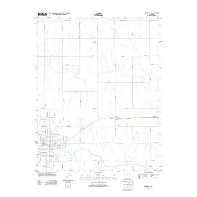
2012 Map of Kingman
USGS Topo · Published 2012About this map
The S Fork Ninnescah River anchors the southern landscape of this Kansas region, where the town of Kingman serves as a primary hub of aviation and local gathering. The presence of Kingman Airport - Clyde Cessna Field highlights the area's connection to early flight history, while the Kingman Fairgrounds marks a traditional center for community life. For those researching family history, Walnut Hill Cem and Schooley Cem provide vital genealogical links to the early residents of Kingman County. The terrain is defined by a network of waterways including Smoots Cr, Hunter Cr, and Lakin Lake, which weave through a grid of section roads. Small named localities like Varner and Georgia reflect the persistence of rural settlements along these drainage basins and transport corridors.
Find a feature on this map
76 named features on this map. Tap any name to fly to it.
Don’t see what you’re looking for? This feature index may not catch every label — zoom into the map to look around manually.
Map Details
Editions of this 2012 Kingman Map
This is the sole edition of this map. No revisions or reprints were ever made.
Other maps of this area

1889 · Cheney
USGS Topo · 1:125,000

1891 · Cheney
USGS Topo · 1:125,000

1892 · Kingman
USGS Topo · 1:125,000

1894 · Kingman
USGS Topo · 1:125,000

1901 · Cheney
USGS Topo · 1:125,000

1955 · Wichita
USGS Topo · 1:250,000

1955 · Pratt
USGS Topo · 1:250,000

1958 · Wichita
USGS Topo · 1:250,000

1959 · Pratt
USGS Topo · 1:250,000
1965 · Waterloo
USGS Topo · 1:24,000