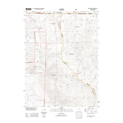
2013 Map of Kings Canyon
USGS Topo · Published 2013About this map
Kings Canyon and the surrounding high-country landscape sit at the intersection of three major federal forests: Medicine Bow National Forest, Routt National Forest, and Roosevelt National Forest. This 2013 survey illustrates a region defined by managed water and recreational access, straddling the Wyoming and Colorado state line and the border of Jackson and Larimer counties. Small outposts like Camp Nelson are surrounded by an extensive network of off-highway vehicle and hiking trails, including the Bear Draw OHV Loop Trail and the Pinkham Mountain Loop Trail.
Find a feature on this map
36 named features on this map. Tap any name to fly to it.
Don’t see what you’re looking for? This feature index may not catch every label — zoom into the map to look around manually.
Map Details
Editions of this 2013 Kings Canyon Map
This is the sole edition of this map. No revisions or reprints were ever made.
Other maps of this area

1906 · Medicine Bow
USGS Topo · 1:125,000

1908 · Medicine Bow
USGS Topo · 1:125,000

1950 · Northgate
USGS Topo · 1:24,000

1950 · Kings Canyon
USGS Topo · 1:24,000

1952 · Northgate
USGS Topo · 1:24,000

1952 · Kings Canyon
USGS Topo · 1:24,000

1954 · Rawlins
USGS Topo · 1:250,000

1954 · Craig
USGS Topo · 1:250,000

1955 · Old Roach
USGS Topo · 1:24,000

1955 · Eagle Hill
USGS Topo · 1:24,000