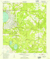
1949 Map of Kingsley
USGS Topo · Published 1953About this map
Camp Blanding dominates the central portion of this 1940s landscape, reflecting its role as a critical installation for military training during and after World War II. The layout of the camp is visible alongside established training grounds like the Machine Gun Range and various other marked ranges. To the north, the perfect circle of Kingsley Lake provides a striking geographic anchor, where the community of Kingsley Beach sits along the shoreline.
Find a feature on this map
21 named features on this map. Tap any name to fly to it.
Don’t see what you’re looking for? This feature index may not catch every label — zoom into the map to look around manually.
Map Details
Editions of this 1949 Kingsley Map
3 editions found
Other maps of this area

1918 · Middleburg
USGS Topo · 1:62,500

1918 · Lawtey
USGS Topo · 1:62,500

1941 · Starke
USGS Topo · 1:62,500

1941 · Middleburg
USGS Topo · 1:62,500

1942 · Ates Creek
USGS Topo · 1:62,500

1948 · Starke
USGS Topo · 1:50,000

1948 · Jacksonville
USGS Topo · 1:250,000

1949 · Rice Creek
USGS Topo · 1:24,000

1949 · Middleburg SW
USGS Topo · 1:24,000

1949 · Gold Head Branch
USGS Topo · 1:24,000