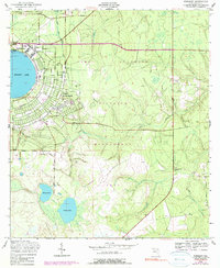
1949 Map of Kingsley
USGS Topo · Published 1990About this map
Camp Blanding dominates this landscape, reflecting a period of significant military presence in north-central Florida shortly after World War II. The map details the transition from the circular shoreline of Kingsley Lake and the recreational hub at Kingsley Beach to the sprawling training grounds of the Camp Blanding Military Reservation. Roadways like Dade Road and Apalachicola Street carve through the woodland, while a dedicated Landing Strip and multiple towers underscore the post-war strategic utility of the site.
Find a feature on this map
23 named features on this map. Tap any name to fly to it.
Don’t see what you’re looking for? This feature index may not catch every label — zoom into the map to look around manually.
Map Details
Editions of this 1949 Kingsley Map
3 editions found
Other maps of this area

1918 · Middleburg
USGS Topo · 1:62,500

1918 · Lawtey
USGS Topo · 1:62,500

1941 · Starke
USGS Topo · 1:62,500

1941 · Middleburg
USGS Topo · 1:62,500

1942 · Ates Creek
USGS Topo · 1:62,500

1948 · Starke
USGS Topo · 1:50,000

1948 · Jacksonville
USGS Topo · 1:250,000

1949 · Rice Creek
USGS Topo · 1:24,000

1949 · Middleburg SW
USGS Topo · 1:24,000

1949 · Gold Head Branch
USGS Topo · 1:24,000