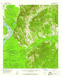
1958 Map of Kingston
USGS Topo · Published 1961About this map
The Mississippi River creates a dynamic western boundary for this mid-century landscape, where the shifting riverbed and cutoff channels like Glasscock Cutoff have shaped the alluvial lowlands. This survey illustrates the intricate drainage patterns of the Homochitto National Forest and the Tansy Island area, revealing a territory defined by its relationship with water and timber. The presence of numerous oil wells across the flats indicates the importance of petroleum extraction to the local economy during this era.
Find a feature on this map
59 named features on this map. Tap any name to fly to it.
Don’t see what you’re looking for? This feature index may not catch every label — zoom into the map to look around manually.
Map Details
Editions of this 1958 Kingston Map
2 editions found

Other maps of this area

1909 · Sycamore Landing
USGS Topo · 1:24,000

1909 · Vidalia
USGS Topo · 1:24,000

1921 · Natchez
USGS Topo · 1:48,000

1922 · Natchez
USGS Topo · 1:62,500

1936 · Woodville
USGS Topo · 1:62,500

1939 · Red Gum
USGS Topo · 1:62,500

1939 · Natchez
USGS Topo · 1:62,500

1939 · Kingston
USGS Topo · 1:62,500

1939 · Artonish
USGS Topo · 1:62,500

1939 · Deer Park
USGS Topo · 1:62,500