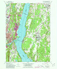
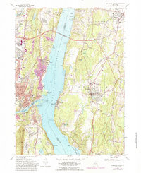
1963 Map of Kingston East
USGS Topo · Published 1981About this map
The Hudson River serves as the central artery for this mid-century survey, dividing Ulster and Dutchess counties. On the western bank, the industrial and transport hub of Kingston is shown in detail, featuring the Kingston-Ulster Airport, the Conrail line, and several historic neighborhoods such as Ponck Hockie. The Kingston-Rhinecliff Bridge provides the primary crossing point, linking the city to the village of Rhinecliff and the sprawling estates of the east bank.
Find a feature on this map
92 named features on this map. Tap any name to fly to it.
Don’t see what you’re looking for? This feature index may not catch every label — zoom into the map to look around manually.
Map Details
Editions of this 1963 Kingston East Map
5 editions found
Other maps of this area

1892 · Kaaterskill
USGS Topo · 1:62,500

1893 · Kaaterskill
USGS Topo · 1:62,500

1894 · Kaaterskill
USGS Topo · 1:62,500

1895 · Catskill
USGS Topo · 1:62,500

1898 · Rhinebeck
USGS Topo · 1:62,500

1899 · Kaaterskill
USGS Topo · 1:62,500

1901 · Rosendale
USGS Topo · 1:62,500

1903 · Rosendale
USGS Topo · 1:62,500

1903 · Kaaterskill
USGS Topo · 1:62,500

1934 · Rhinebeck
USGS Topo · 1:48,000