
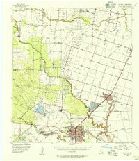
1954 Map of Kingsville
USGS Topo · Published 1956About this map
The Kingsville area in the mid-1950s was a hub of South Texas education, industry, and military activity. The city grid is dominated by the Texas College of Arts and Industries campus and a centralized City Hall, while the eastern landscape features the sprawling Kingsville Naval Air Station. Industrial development is evident through the massive Celanese Plant and numerous energy facilities like the Gas Transmission Plant and Borregos Oil Field, reflecting the era's petrochemical expansion. The Missouri Pacific railroad serves as the primary transport spine, connecting the agricultural and industrial centers of Bishop and Driscoll. Beyond the city, the landscape transitions into the legendary King Ranch, where natural features like Santa Gertrudis Creek and the Escondido Trap illustrate the scale of the regional cattle industry and water management practices of the period.
Find a feature on this map
31 named features on this map. Tap any name to fly to it.
Don’t see what you’re looking for? This feature index may not catch every label — zoom into the map to look around manually.
Map Details
Editions of this 1954 Kingsville Map
2 editions found
Other maps of this area

1917 · Ben Bolt
USGS Topo · 1:62,500

1920 · San Diego
USGS Topo · 1:62,500

1921 · Falfurrias
USGS Topo · 1:125,000

1924 · Petronilla
USGS Topo · 1:62,500

1925 · Robstown
USGS Topo · 1:62,500

1928 · Sarita
USGS Topo · 1:125,000

1950 · Corpus Christi
USGS Topo · 1:250,000

1952 · Riviera Beach NW
USGS Topo · 1:24,000

1952 · Riviera Beach
USGS Topo · 1:62,500

1954 · Orange Grove
USGS Topo · 1:62,500