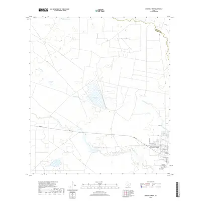
2019 Map of Kingsville West
USGS Topo · Published 2019About this map
Kingsville sits at the eastern edge of this South Texas landscape, where the street grid meets an expansive network of creeks and ephemeral lakes. The western outskirts of the city are defined by a mix of residential development and open ranch land, transitionally marked by the course of Tranquitas Cr as it flows toward Tranquitas Lake. To the south, local history is preserved at Chamberlain Cem and the Santo Gertrudis Memorial Cem, located near the southern reach of S Wells St. Beyond the city limits, the terrain is characterized by a series of significant water features including Los Indios Lake and Ogados Lake, alongside the storied Posta Water-Hole. This area is shaped by the intermittent drainages of Santa Gertrudis Cr and San Fernando Cr, the latter forming a portion of the boundary between Nueces and Kleberg counties.
Find a feature on this map
37 named features on this map. Tap any name to fly to it.
Don’t see what you’re looking for? This feature index may not catch every label — zoom into the map to look around manually.
Map Details
Editions of this 2019 Kingsville West Map
This is the sole edition of this map. No revisions or reprints were ever made.
Other maps of this area

1917 · Ben Bolt
USGS Topo · 1:62,500

1921 · Falfurrias
USGS Topo · 1:125,000

1928 · Sarita
USGS Topo · 1:125,000

1950 · Corpus Christi
USGS Topo · 1:250,000

1954 · Kingsville
USGS Topo · 1:62,500

1954 · Riviera
USGS Topo · 1:62,500

1956 · Corpus Christi
USGS Topo · 1:250,000

1956 · Laredo
USGS Topo · 1:250,000

1960 · Corpus Christi
USGS Topo · 1:250,000

1963 · Ben Bolt SE
USGS Topo · 1:24,000