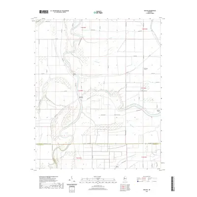
2020 Map of Kinlock
USGS Topo · Published 2020About this map
The Big Sunflower River and Bogue Phalia define the landscape of this Delta region, where the intersection of Washington Co, Sunflower Co, and Humphreys Co reveals a complex network of waterways and drainage features. The settlement of Kinlock sits near the center of a terrain characterized by agricultural roads and significant riparian features like Dutch Brake, Melton Lake, and Dutch Bayou. Cultural and historical markers are preserved in the form of the Prentiss Mound and the prominent Hickory Bluff area, which includes the Hickory Bluff Cemetery.
Find a feature on this map
63 named features on this map. Tap any name to fly to it.
Don’t see what you’re looking for? This feature index may not catch every label — zoom into the map to look around manually.
Map Details
Editions of this 2020 Kinlock Map
This is the sole edition of this map. No revisions or reprints were ever made.
Other maps of this area

1939 · Tralake
USGS Topo · 1:62,500

1939 · Swan Lake
USGS Topo · 1:62,500

1940 · Auter
USGS Topo · 1:62,500

1940 · Baird
USGS Topo · 1:62,500

1953 · Greenwood
USGS Topo · 1:250,000

1956 · Greenwood
USGS Topo · 1:250,000

1965 · Inverness
USGS Topo · 1:24,000

1965 · Indianola
USGS Topo · 1:24,000

1965 · Kinlock
USGS Topo · 1:24,000
1965 · Bellewood
USGS Topo · 1:24,000